SOUTH CAROLINA GOLD MAPS
A typical sample of the gold maps taken from a portion of the Gold map from the Charlotte, North Carolina Vicinty Gold maps is shown below.
DISCOVER GOLD - TAKE A GOLD TREK
GOLD IN SOUTH CAROLINA - GOLD MAPS FOR GOLD PANNING, METAL DETECTING AND PROSPECTING. GOLD MAPS ARE GREAT FOR GOLD PANNERS, GOLD METAL DETECTING, GOLD PROSPECTORS, ROCK HOUNDS, CAMPERS, HIKERS, AND GEOLOGIST. THE LOCATION AND MINERAL OCCURRENCE OF GOLD FOR THESE SITES CAME FROM EXTENSIVE RESEARCH OF THE SOUTH CAROLINA DATA FILES FROM THE U.S.G.S. DOCUMENTS. (MRDS FILES) GOLD MAPS INCLUDE GPS DATA AND WERE PREPARED IN THE AREAS OF SOUTH CAROLINA IN WHICH THE MOST OCCURRENCE OF GOLD HAS BEEN FOUND AND ARE LISTED BELOW.
There is still gold in the creeks and streams in South Carolina. . The best chance to find Gold in these creeks and streams, placer deposits, and near old mines and prospects, is to know where the occurrence of gold has been found. Before you dig or pan for Gold you will need a map to show you where to look. These Gold Maps provide you with past gold mines, placers and prospect sites. The venture will be interesting and challenging. When you do make a Gold find it will be very exciting. In the past, it was not uncommon for one to find 1 to 6 ounce nuggets in the streams and placers. Those days may be gone, but with some luck and a lot of determination you may find some gold or even a gold nugget.
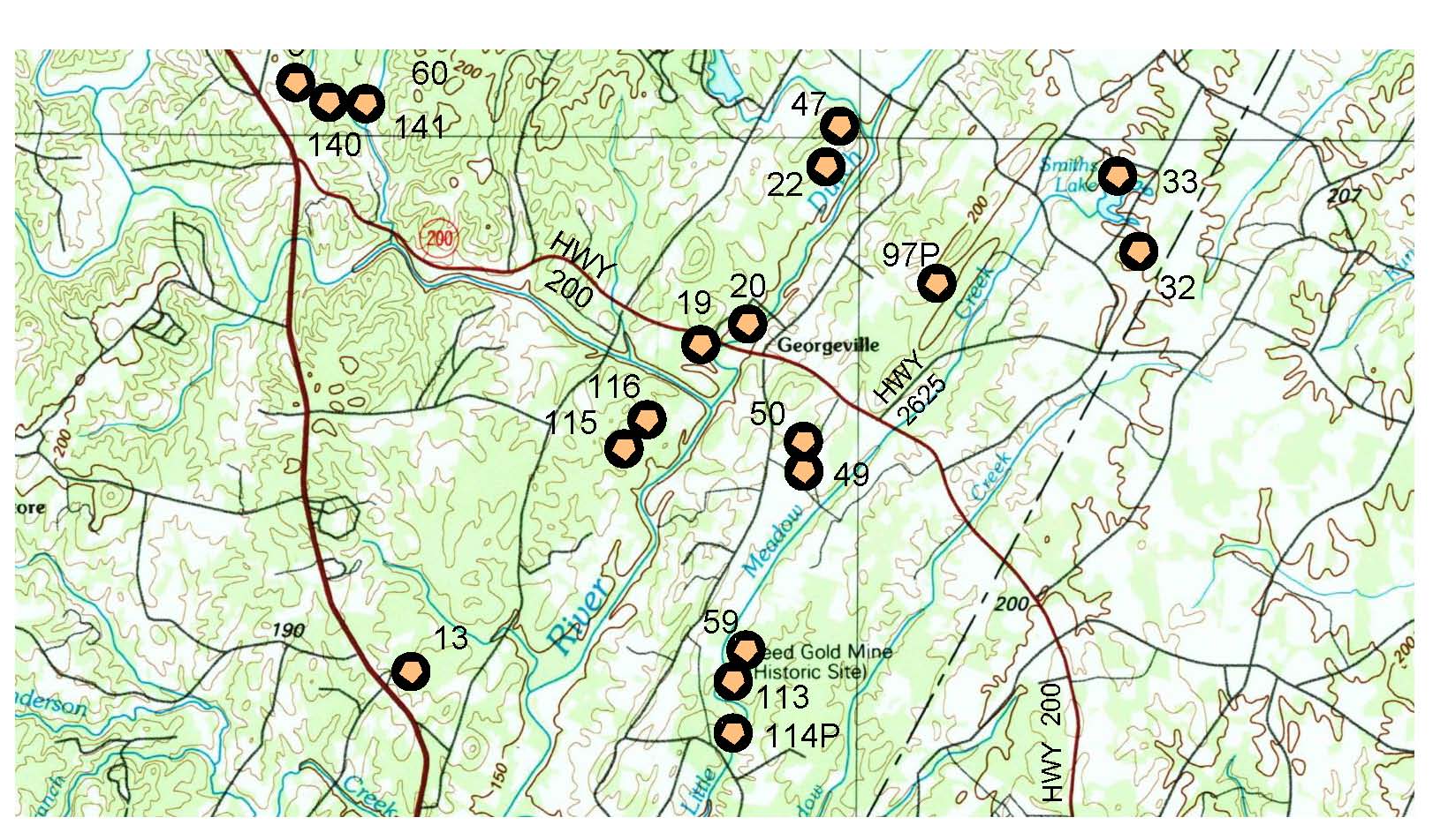
A typical sample of the gold maps taken from a portion of the Gold map from the Charlotte, North Carolina Vicinty Gold maps is shown below.
The gold sites are noted and shown with a numerical number next to each site. These gold sites represent where gold has been found in the past. The number is referenced to a north latitude and west longitude point. These are GPS points that you can use to find the gold sites in the field. The gold sites are shown adjacent to access roads and streams. The sites are plotted on a USGS topographic map which shows the contours of the land. A 'P' next to the record number shows were placer gold deposits have been found.
Recreational Gold panning is allowed within the National Forest.

The cross hatched areas shows the gold maps that are for sale in the state of South Carolina.
The gold vicinity maps, as shown in the index above, provides a table of the number of official recorded gold sites found in the gold maps and shows the towns and cities located in the gold map.